HOW TO SCOUT FOR BASS
Time of Year and Maps
 EDITOR'S
NOTE: Have you ever wondered why bass angling professionals
can come to a lake they've never fished before, compete
for three days, and catch more and bigger bass than
the anglers who live on the lake? Actually the reason
is simple. Most of the work of locating the fish is
done prior to these professionals' coming to the lake.
Many times their preparation for the tournament may
have taken place months before the actual contest. They
also have another advantage that fishermen who angle
the same lake every weekend don't have, because these
pros don't have honey holes, favorite spots or places
to go to where they've caught bass in the past. So they
must rely on their own ability to find the fish on the
lake where the bass should be when the fish are supposed
to be there - without any pre-conceived ideas about
where the bass are. EDITOR'S
NOTE: Have you ever wondered why bass angling professionals
can come to a lake they've never fished before, compete
for three days, and catch more and bigger bass than
the anglers who live on the lake? Actually the reason
is simple. Most of the work of locating the fish is
done prior to these professionals' coming to the lake.
Many times their preparation for the tournament may
have taken place months before the actual contest. They
also have another advantage that fishermen who angle
the same lake every weekend don't have, because these
pros don't have honey holes, favorite spots or places
to go to where they've caught bass in the past. So they
must rely on their own ability to find the fish on the
lake where the bass should be when the fish are supposed
to be there - without any pre-conceived ideas about
where the bass are.
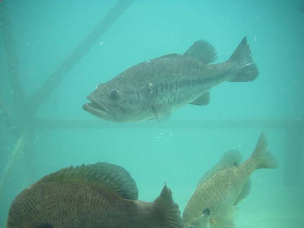
Knowing the month you'll be fishing on a lake helps
you more accurately predict where the bass will be,
since water temperature is a critical factor in locating
bass. Although most sportsmen generalize about where
bass should be during certain times of the year, if
you are seriously trying to catch bass, the best way
to accurately predict where the bass should be is to
call the fisheries biologist in the state where you
plan to fish. Tell him the specific lake on which you
need information, and ask him where the bass should
be on their seasonal migration pattern at that time
of the year on that particular lake.
 If
you're fishing in the winter, the bass will most likely
be positioned in deeper water along the edges of creek
and river channels. If you'll be fishing for pre-spawn
bass, then the fish should be holding close to spawning
areas in ditches, gullies, potholes and drops. If you're
angling during the spawn, the bass will most likely
be in shallow water. If you don't reach the lake until
after the spawn, the bass may have returned to the potholes,
ditches and small drop-offs they’ve been using
during the pre-spawn period. When angling in the hot
summertime, the bass may be back on the deep creek channels
and along points- except early in the morning and late
in the afternoon. If
you're fishing in the winter, the bass will most likely
be positioned in deeper water along the edges of creek
and river channels. If you'll be fishing for pre-spawn
bass, then the fish should be holding close to spawning
areas in ditches, gullies, potholes and drops. If you're
angling during the spawn, the bass will most likely
be in shallow water. If you don't reach the lake until
after the spawn, the bass may have returned to the potholes,
ditches and small drop-offs they’ve been using
during the pre-spawn period. When angling in the hot
summertime, the bass may be back on the deep creek channels
and along points- except early in the morning and late
in the afternoon.
But the person who can best tell you where to expect
the bass to be is the state fisheries biologist and
more specifically, the fisheries biologist who has the
responsibility of that particular lake you plan to fish.
From this biologist, you'll also learn at what exact
water temperature the bass go to the bed, which baits
bass prefer at this time of the year, what type of structure
is in the lake, and where this cover is located. Fisheries
biologists are the most underused source of fishing
information available to the angler- yet they are often
the most knowledgeable.
 Several
types of maps are critical to successful scouting for
bass. Many sportsmen don't know which road to take and
which marina to use to put them closest to the area
of the lake they want to fish. A road map can tell you
exactly how to get to where you want to go to begin
your fishing expedition. A general lake map is also
helpful, because it will show you an overview of the
lake as well as have the marinas, launching areas, gas
stops and campsites marked on it. Too, a general lake
map will picture where major tributaries enter the lake
and give you a visual image of the surface of the water
where you'll be fishing. The third map needed and considered
by many anglers to be the most critical for successful
bassing is a topo map. Any fisherman who cannot read,
understand and follow a topo map is fishing with one
eye closed and one hand tied behind his back for several
reasons. Bass relate to structure, water flow, temperature
changes and bottom breaks. A topo map will show you
where those bottom breaks occur, what the depths of
points are, and where small feeder streams fed into
the main river before the lake was impounded. Several
types of maps are critical to successful scouting for
bass. Many sportsmen don't know which road to take and
which marina to use to put them closest to the area
of the lake they want to fish. A road map can tell you
exactly how to get to where you want to go to begin
your fishing expedition. A general lake map is also
helpful, because it will show you an overview of the
lake as well as have the marinas, launching areas, gas
stops and campsites marked on it. Too, a general lake
map will picture where major tributaries enter the lake
and give you a visual image of the surface of the water
where you'll be fishing. The third map needed and considered
by many anglers to be the most critical for successful
bassing is a topo map. Any fisherman who cannot read,
understand and follow a topo map is fishing with one
eye closed and one hand tied behind his back for several
reasons. Bass relate to structure, water flow, temperature
changes and bottom breaks. A topo map will show you
where those bottom breaks occur, what the depths of
points are, and where small feeder streams fed into
the main river before the lake was impounded.
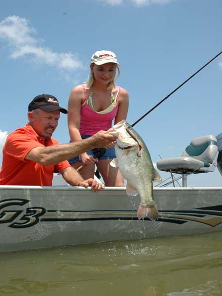
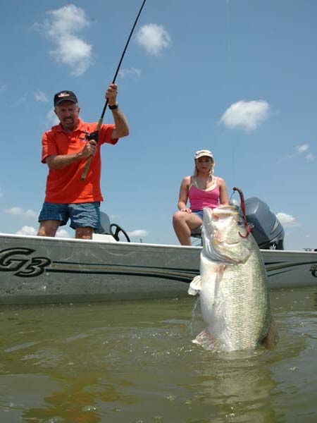
Larry Nixon of Bee Branch, Arkansas, once showed me
one of the ingredients that make him one of America's
best bass fishermen. As I watched, Nixon studied a topo
map for 10 minutes as we motored out on a lake. Then
he accelerated the engine, and we roared across the
water for about 15 minutes. When Nixon throttled back,
we were a half-mile from the bank on our left and a
mile and a half from the right-hand bank. He walked
to the front of the boat, lowered his trolling motor,
and in less than two minutes announced, "There
it is." Thirty-two casts later Nixon had put a
4-1/2-pound and a 5-1/2-pound  largemouth
in the boat. When I asked him what he was fishing on,
he explained, "There's a bottom break that's about
50-yards long in the middle of the lake. The bottom
drops off from 12 feet to 18 feet and then to 25 feet.
I spotted this small ledge on that topo map. Because
I'm so accustomed to reading a topo map, I was able
to go right to this ledge. The major bottom breaks in
most reservoirs are fished by many anglers. When you
can find a little, subtle bottom break like this that
most fishermen never see, often you can find big bass
ganged-up on it. Remember, one of those small bottom
breaks like this one helped Rick Clunn win a B.A.S.S.
Masters Classic in Arkansas on the Arkansas River."
This same kind of small bottom break aided George Cochran
in his winning the 1987 B.A.S.S. Masters Classic in
Louisville, Kentucky, on the Ohio River. By learning
how to read and more importantly how to study and interpret
a topo map, a fisherman can find honey holes he never
could locate by riding the water. largemouth
in the boat. When I asked him what he was fishing on,
he explained, "There's a bottom break that's about
50-yards long in the middle of the lake. The bottom
drops off from 12 feet to 18 feet and then to 25 feet.
I spotted this small ledge on that topo map. Because
I'm so accustomed to reading a topo map, I was able
to go right to this ledge. The major bottom breaks in
most reservoirs are fished by many anglers. When you
can find a little, subtle bottom break like this that
most fishermen never see, often you can find big bass
ganged-up on it. Remember, one of those small bottom
breaks like this one helped Rick Clunn win a B.A.S.S.
Masters Classic in Arkansas on the Arkansas River."
This same kind of small bottom break aided George Cochran
in his winning the 1987 B.A.S.S. Masters Classic in
Louisville, Kentucky, on the Ohio River. By learning
how to read and more importantly how to study and interpret
a topo map, a fisherman can find honey holes he never
could locate by riding the water.
TOMMOROW: AN AERIAL LOOK
|